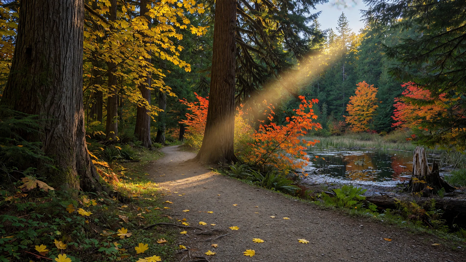
Late October in the high Cascades can be a gamble, but there is one walk in Lewis County that stays reliably open when the alpine trails start to snow in: the Woods Creek Watchable Wildlife Trail, a gentle gravel loop just south of Randle. It sits low, around 1,000 feet of elevation, it turns a brilliant gold with big-leaf maple and vine maple in the fall, and it is built for slow, curious walking: five signed habitats, a beaver pond, and some of the easiest quality birdwatching in the Gifford Pinchot National Forest. If you want a snow-free October afternoon in the woods without a long drive or a big climb, this is the spot.
Where is Woods Creek and how do I get there?
The trailhead is in the Cowlitz Valley Ranger District of Gifford Pinchot National Forest, a short drive south of Randle. From Highway 12 in Randle, head south on Highway 131 (the Mount St. Helens route, which becomes Forest Roads 23 and 25), bear right where FR 23 and FR 25 split, and follow FR 25 for about seven to eight miles to the signed trailhead on the left. FR 25 is a maintained forest road, fine for a passenger car in dry weather, and the day-use area has a vault toilet, picnic tables with grills, and a covered picnic shelter. The ranger district office at 10024 US Highway 12 in Randle, (360) 497-1100, can confirm road conditions before you head out.
What makes the main loop special?
Trail 247 is a roughly 1.5-mile loop built as a wide, compacted gravel path that is accessible to wheelchairs and strollers. It is laid out as a figure eight, so you can walk the easy lower loop on its own or add both loops for a longer outing of about 2.5 miles. Along the way the trail winds through five signed habitat areas: a mixed hardwood-conifer forest of big-leaf maple, vine maple, and alder; an open meadow; a beaver pond and wetland; and groves of old Douglas fir. It crosses Woods Creek on a small bridge, and interpretive signs at each stop explain what you are looking at. The whole thing is an easy walk with modest grades, well under an hour at a brisk pace, or a slow, lovely morning if you stop to look.
The Old Growth Loop: the payoff
If you want the big trees, branch onto Trail 247A, the Old Growth Loop. It is about a mile long and climbs through a stand of old-growth Douglas fir, the kind of towering, quiet forest that takes a couple of centuries to build. The elevation gain is roughly 300 feet over the branch, which makes it the one real climb of the day, but it stays gentle and family-friendly. This is the Lewis County forest people picture when they talk about the Pacific Northwest, and it is the reason to bring your camera.
What wildlife will I see?
Woods Creek is named a Watchable Wildlife Area for a reason. The beaver pond is the centerpiece: look for beaver sign and ducks on the water, and watch the wetland edges for herons. Fall migration pulls birds through the mixed forest, and the meadow and brushy edges are good for songbirds and woodpeckers. Along the path you will also find interpretive paw-print displays for the animals that share this forest: marten, beaver, elk, deer, coyote, and black bear. You likely will not spot most of them mid-day, but fresh tracks and sign show the trail is busy with wildlife, and dawn and dusk are the times to actually catch a glimpse.
When is the best time to visit?
The trail is generally snow-free from late May through late October, which makes it a dependable fall destination when the higher trails around Packwood and White Pass are already dusted. October is also its best-looking month: the big-leaf maple, vine maple, and alder along the creek and the lower loop turn a burst of gold and orange, and the lower sun throws long, warm light through the forest. Mornings are the quietest and best for birds. Mosquitoes can be thick in the summer months, so fall is actually the more comfortable season to go.
Practical tips for your visit
- Check the pass sign: sources differ on whether a Northwest Forest Pass is required at this trailhead, so the sign at the parking area is the final word. If one is needed, daily Northwest Forest Passes are sold at ranger stations and many local stores. The Forest Service page has current details.
- Call ahead about FR 25: the road is maintained, but the ranger district at (360) 497-1100 can confirm conditions before you drive out.
- Dress for the Cowlitz Valley in October: cool and damp, so bring layers, a rain shell, and waterproof shoes for the mud.
- Pack binoculars and a camera: for the birds, the fall color, and the old-growth trees.
- Take it slow: the point of a watchable wildlife trail is to watch. Give yourself an hour and a half for the loops with stops.
Make a day of it
The Woods Creek trail is an easy half-day, which leaves room to explore the rest of the Randle country. Add the short Layser Cave Trail, about 1.6 miles up Forest Road 2300.084 off the Cispus Road: a gentle quarter-mile walk down to a cave that is one of the most significant archaeological sites in western Washington, used by native peoples for more than 7,000 years, with a view of Mount Adams along the way. In Randle, refuel at Roxy's Roadhouse on Highway 12, or head over to Morton for coffee at Main Avenue Coffeehouse and Bakery. This is also the same country we covered in our elk bugling drive guide, and the low-elevation Cispus waterfall hikes are a short drive away on the Cispus Road. For nearby community context, the Morton and Packwood guides are a good read over lunch.
Woods Creek is Lewis County's easiest adventure with the biggest return: a low-elevation forest walk that stays open through the fall, full of big trees, a beaver pond, and the quiet kind of wildlife watching that rewards a slow pace.