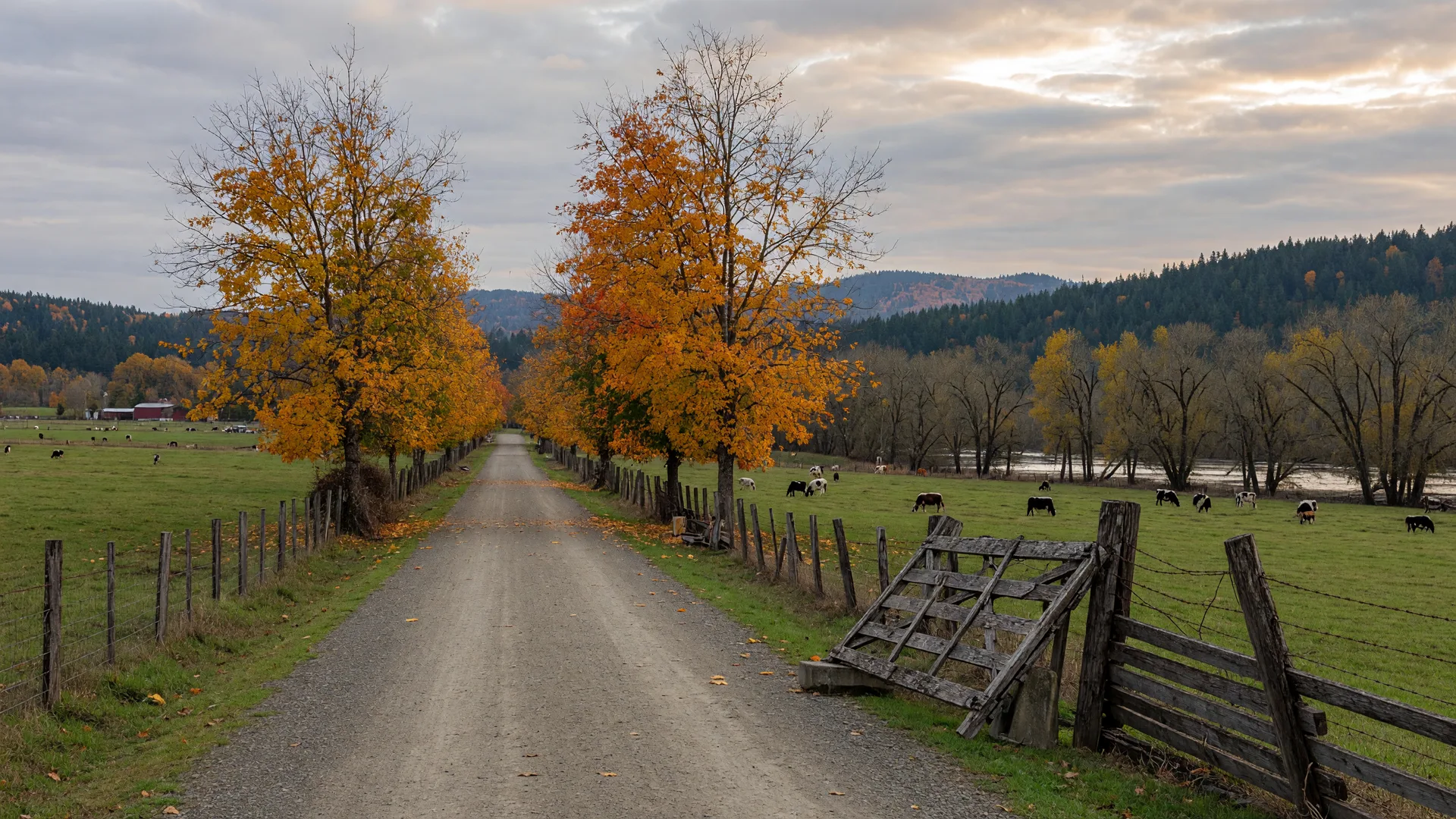
Late October usually means saying goodbye to trail season in the Cascades, but Lewis County has a secret weapon for the dark months: the Willapa Hills State Park Trail, a flat, snow-free rail trail that follows the old Northern Pacific corridor out of Chehalis and straight up the Chehalis River valley. Its best stretch, the roughly 22 miles from Chehalis to Pe Ell, stays open all year, crosses farmland and timber country that turns gold well into November, and is easy enough that a family on cruisers, a runner, or a stroller-and-walkers crowd can all enjoy it. On a crisp late-October morning, with the valley quiet and the maples still blazing, it is one of the finest afternoons the county has to offer.
Where does the trail start and how do I get there?
The trail's east end sits right on the edge of Chehalis. The Chehalis trailhead is off SW Sylvenus Street near SW Hillburger Road, on the west side of town, with a parking lot, including accessible spaces, and trailhead facilities. From there the trail heads roughly west-southwest up the Chehalis River valley, passing through Adna, over Ceres Hill, through the Dryad and Doty country, past Rainbow Falls State Park, and ending 22 miles later at the Pe Ell trailhead on Fourth Avenue and Front Street. Most people start in Chehalis because it is closest to I-5, but you can start at either end. The trail is also a designated stop on the full 56-mile route that continues from Pe Ell into Pacific County all the way to South Bend, which is a great excuse to come back and ride it in sections. The Washington State Parks page has the full trailhead list and details.
How hard is the trail, really?
Easy, gloriously easy. The Willapa Hills Trail is an old railroad grade, which means it was built for trains: grades top out around two percent and the elevation barely changes for the whole ride. The first roughly five miles from Chehalis through Adna are paved asphalt, smooth enough for a road bike or a stroller, and after that the surface turns to compacted gravel that is firm and well-drained in most weather. Bikes, e-bikes, walkers, runners, skaters, and horseback riders all share the corridor. Washington State Parks allows pedal-assist Class 1 and Class 3 e-bikes on this trail, a nice option if you want to cover the whole 22-mile section without being a serious athlete. The Chehalis to Adna round trip is about ten miles of nearly flat, all-weather trail, an easy afternoon on foot or a quick hour on wheels.
What will I see along the way?
The trail is a rolling postcard of Lewis County's working landscape. For the first few miles you climb out of Chehalis through mixed farmland, then drop into the broad Chehalis River valley, where the corridor threads between pasture, dairy barns, and thickets of big-leaf maple and alder. Old railroad artifacts line the way, wooden trestles, cattle guards, and the occasional weathered mile marker, reminders that the rails ran through here for more than a century. Around mile five the pavement ends at Adna, a small farming community that is worth a stop for its quiet streets and the riverside county parks along the Chehalis. West of Adna the trail crosses Ceres Hill, then the wide floodplain around Doty and Dryad, where you start to share the valley with the Chehalis River itself. By late October the vine maple and big-leaf maple along the corridor are turning gold and orange, and the low autumn sun makes the whole valley glow.
Rainbow Falls State Park: the waterfall stop
About sixteen miles west of Chehalis on State Route 6, the trail delivers one of its best rewards: Rainbow Falls State Park, a small but fast cascade where the Chehalis River slides over a shelf of rock and, when the sun is out, throws a rainbow through its own mist. The Willapa Hills Trail runs right past the park, just across Leudinghaus Road from the main entrance, and a short signed spur brings you in. The day-use area has picnic shelters and tables on the river, and the self-guided Oxalis Loop nature walk winds through a remnant of old-growth forest with towering Douglas fir and cedar. One honest note: the park's bridges across the Chehalis were destroyed in the December 2007 flood, so the old-growth trail system on the south side of the river is reached by roadside parking along State Route 6 rather than by footbridge. The falls viewpoint, the picnic area, and the Oxalis Loop on the north side are all easy to reach. The park page has current hours and amenities.
When is the best time to visit?
Unlike the high-country trails around Packwood and Randle, the Willapa Hills Trail never closes for snow. It is open every day, 8 a.m. to dusk, and the low elevation, the Chehalis trailhead sits around 186 feet, keeps it snow-free through the winter. Late October and November are genuinely some of its best months: the fall color lingers in the river valley well into November, the summer crowds are gone, and a crisp, dry day brings that particular northwest light where the hills go blue and the maples glow. Spring is the other standout season, with green pastures, wildflowers, and the river running full. If you are planning a long ride, note that a trail-improvement closure runs from October 19, 2026 through the end of January 2027, but it only affects the Pacific County stretch near Raymond, from LeBam to Heckard Road, so the Chehalis to Pe Ell section in Lewis County is fully open.
Practical tips for your visit
- Bring a Discover Pass: Washington State Parks requires a Discover Pass for vehicles at trailheads, and the Chehalis trailhead has limited spaces, so arrive early on a nice weekend. Check the State Parks page for the current rules.
- Know the surface switch: it is asphalt for about the first five miles through Adna, then compacted gravel to Pe Ell. A hybrid or gravel bike with wider tires rides much more comfortably past Adna.
- Plan around the restrooms: trailhead restrooms exist but have a reputation for being locked, so make your plans before you head out.
- Dress for the valley: cool and damp in late fall, so bring layers and a rain shell; mornings can be frosty on the open farmland.
- Pack water and a snack: the trail is rural, and there are no services along the corridor until Pe Ell.
- Keep an eye out for wildlife: deer and elk use the valley, bald eagles fish the river, and salmon season brings the river alive in fall.
Make a day of it
Start in Chehalis with coffee at Owl and Olive Cafe on Highway 6, or take the short walk from downtown and the Chehalis-Centralia Railroad & Museum to the trailhead. Ride or walk out to Adna for a look at the riverside parks, then push on toward Doty and Dryad. In Pe Ell, refuel at Evey's Cafe on North Main Street or grab a coffee at Rainy Day Coffee Company before turning around. Because the trail is a straight line, you can also set up a car shuttle, leave one car at the Pe Ell trailhead and one at Chehalis, ride one way, and enjoy the whole 22 miles without doubling back. For more Lewis County exploring, the downtown Chehalis walking tour makes a natural pairing, and the Adna community guide covers the farmland this trail runs through. The Things to Do page has more of the county's best outdoor stops nearby.
The Willapa Hills Trail is the gift that keeps giving in Lewis County: a flat, snow-free corridor through the farm valley that turns golden in November, close to town, easy for everyone, and full of the quiet beauty that makes this county special.