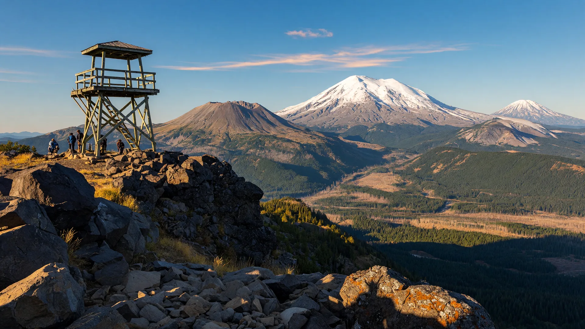
Some hikes deliver a payoff at the end, and a few deliver one that stops you cold in your tracks. High Rock Lookout on Sawtooth Ridge is firmly in the second group. From a lonely fire lookout perched on a basalt ridgetop, you get an in-your-face view of Mount Rainier to the north, the scarred summit of Mount St. Helens to the west, and Mount Adams adrift on the southern horizon. It is the Lewis County classic for admiring the big Cascade volcanoes all at once, and it is closer than you might think.
Where is High Rock Lookout and how do I get there?
High Rock Lookout sits high on Sawtooth Ridge in the Gifford Pinchot National Forest, east of the Lewis County line in the Randle and Packwood country. There are two common ways in. From Packwood, take Highway 706 west toward Ashford, then turn onto Forest Road 52 (Skate Creek Road) and continue to the High Rock trailhead. From Randle, follow Forest Road 25 or 99 up toward the ridge and connect by the same network. Whichever route you take, the last stretch is on rough gravel forest roads that are generally passable in a high-clearance or all-wheel-drive vehicle; check conditions before you go, especially early or late in the season.
What is the hike like?
The main trail to High Rock Lookout is about 3.2 miles round trip with roughly 1,350 feet of elevation gain, rated moderate. It starts on an old roadbed and climbs steadily up the flank of the ridge through mossy forest and open meadows. There are a couple of stretches of steep, loose tread where poles help, and one short, exposed rocky pitch near the top that is worth taking slowly. Take your time, stop for the lake and meadow views along the way, and you will be at the summit in an hour and a half to two hours.
The lookout, listed on the National Register of Historic Places, sits right at the cliff edge on a 5,685-foot summit. The old tower is fenced off for safety, and you are asked to enjoy the views from outside the structure rather than climbing it. That is no hardship: the 360-degree panorama is the whole point. Mount Rainier fills the skyline to the north, Cora Lake glints far below in the bowl of the ridge, and on a clear day you can trace the Cascades from Mount Adams in the south across to the crumbled summit of Mount St. Helens.
When is the best time to go?
High Rock is a snow-free summer hike, best from roughly June into October. Late August and early September are ideal: the trails are dry, the wildflowers have faded into golden meadow grass, and the fall colors on the vine maple start to creep in at the higher elevations. The views are clearest on crisp mornings after a weather front has pushed through, so watch the forecast and pick a clear, calm day. Smoke from late-summer wildfires can haze the scenery, so if visibility matters to you, check the air quality before you drive up.
Is there a permit or pass?
High Rock Lookout itself requires no climbing permit or special entry reservation. Washington Trails Association lists it as a no-fee hike, which makes it an easy, low-cost adventure compared with summit routes. Arrive early on weekends, because the small trailhead lot fills fast with hikers angling for those volcano views. Drive with care on the forest roads and pack out everything you pack in to keep this little corner of the national forest pristine.
What about hiking nearer to Mount St. Helens itself?
If it is the mountain that draws you, the south-side access points near Cougar on Highway 503 reach classic Mount St. Helens trails like the Ape Canyon Trail (about 9.4 miles round trip, moderate to hard), which climbs through old-growth forest to a cinder plateau with open views of the crater. On the north side, note that the Johnston Ridge Observatory trailhead on the Spirit Lake Highway remains closed through at least 2027 after a 2023 landslide took out the road, so the Hummocks and Harrys Ridge hikes that start from there are not reachable right now. High Rock is a perfect stand-in: you get a front-row seat on Mount St. Helens from a trail that is open, family-doable, and all in Lewis County country.
What should I bring?
- Trekking poles: genuinely helpful on the loose, rocky pitches near the top.
- Layers and a windbreaker: the ridgetop is exposed and the wind can be sharp even on a warm valley day.
- Water and snacks: there is no water on the trail and no facilities at the top.
- Sunscreen and a hat: at 5,685 feet with no shade on the summit, you will feel the sun.
- A camera: the three-volcano panorama is the whole reason you came.
- A Discover Pass or recreation pass check: confirm parking rules for the trailhead you use before you go.
A few tips for visitors
Give yourself a full half day for the drive up, the hike, and time to linger at the top. The final forest-road miles are slow, so budget for them. Arrive early on a clear weekend morning for the quietest, most open views, and remember that weather can change fast on the ridge, so turn around if thunderheads build. If you want to extend the day, the Randle and Packwood area just a short drive west offers burgers, fuel, and a warm welcome to round out an adventure that feels deep in the mountains and a world away from the highway.
There are easier trails in Lewis County, but none with a payoff quite like this: three of the Cascades' greatest volcanoes laid out before you from a fire lookout that has watched over the range for a century. That is the High Rock we keep coming back to.